1940-2008: The Koester Site
A significant shift at the Koester Prairie site took place during the 1940s. After Walter Koester purchased the various portions of land that now comprise the WMA (see Koester Prairie History), the economic base of the farm shifted from dairy to beef cattle. As beef did not require the daily land labor involved in milking, beef herds were larger, and the grassland expanded.
Why cattle grazing?
Cattle grazing was both agriculturally and economically valuable. During this time period, farmers needed new agricultural techniques that would regulate plant growth without disturbing plant roots or causing more soil destabilization. As a result, cattle were adopted not only for grazing but also for producing economic benefits with dairy and meat.
Landscape Before Cattle Grazing
In 1938, aerial photos were taken of the site, enabling us to see the condition of the land. At that time, the area was divided among a number of landowners.
Oak Savanna
The inverted "V" at the left center of the photo shows the hillsides of the savanna dotted with oak trees. On the left side of the of the savanna is grassland, which was a pasture that could be grazed by dairy cows. The dairy barn is in the white area slightly northwest of the inverted "V."

Aerial view of section 25 (1938).
Wet Prairie
In the upper middle of the photo is a darker gray area, which has trees at its northern end. The soil there was damp and there were many scrub trees. This area, not cultivated at the time, was called a "slough."
Mesic Prairie
Directly to the east of the inverted "V" is the remaining prairie, which was grazed. The triangular light gray area shows that hay was cut from the flat area on top of the grassland. Southeast of the inverted "V" the land has been cultivated.
Landscape During Cattle Grazing
An aerial map from 1951 shows changes in land since 1938.
Oak Savanna
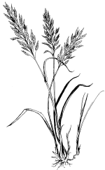
The fields to the south of the prairie visible in the 1938 photo were planted with non-native grasses like Timothy and Brome. The savanna continues to appear as an inverted "V" toward the left side of the photo. The new enlarged grassland appear to the east as a large un broken expanse.
Wet Prairie
During the 1940s, the wet prairie was drained through the use of tiling. As a result, the "slough" was turned into cultivated fields.

Aerial view of sections of 25 and 26 (1951).
Landscape Before and After: Cattle Grazing
Click on the map to compare the two aerial views of the landscape (1938 vs. 1951).

Aerial view of section 25 (1938).

Aerial view of sections of 25 and 26 (1951).

Aerial view of section 25 (1938).
Explore the prairie history by navigating the different periods of the site using the table of contents below.


